Sinking Joshimath: Hyderabad geophysical scientists to study land subsidence issue
text_fieldsHyderabad: According to a senior scientist, a team of specialists from the CSIR-National Geophysical Research Institute (NGRI) will travel to Joshimath in Uttarakhand, which recently experienced land subsidence, to conduct subsurface physical mapping of the affected town.
Anand K. Pandey's 10-person team is anticipated to arrive at the work site on January 13 and go to work the following day. The tests are anticipated to last for two weeks, after which the collected data will be examined to determine the cause of the sinking ground there.
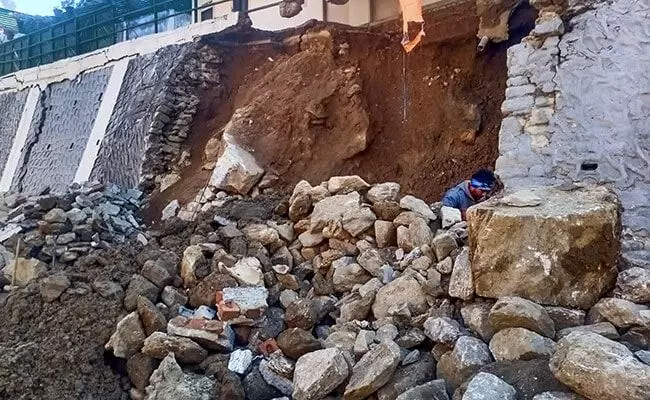
Joshimath, the gateway to famous pilgrimage sites like Badrinath and Hemkund Sahib and international skiing destination Auli, is facing a major challenge due to land subsidence.
“Our equipment is already on the way. On 13th January, the whole team will move to this site. And from the 14th onwards, we will be there for at least two weeks to do the survey of that area. We are planning to do shallow subsurface physical mapping for water saturation and soil characteristics,” Pandey told PTI
He further said NGRI has been conducting several research works in Uttarakhand for the past four years in the areas of earthquakes, floods and landslides.
Pandey said they are going to do an electrical survey which is very important in such seismic zones.
The senior scientist said they will be using the multi-channel analysis of surface waves (MASW) method, a non-destructive seismic method to evaluate material layer thickness and its shear wave velocity, to measure the thickness of the soil.
The team will also use ground penetration to find out minor cracks, and water saturation of smaller sizes or fractures in the subsoil or cavities using ground penetrating radar.
“In addition to that, we are also using field mapping,” he said.
NGRI is one of the largest scientific networks in Uttarakhand and in future, the institute will be able to provide early warnings about floods also, he said.
The number of subsidence-affected homes rose to 678 while 27 more families were evacuated to safety, a bulletin from the Disaster Management Authority in Chamoli said on January 9, adding that 82 families have been shifted to safe locations in the town so far.
The Centre on Tuesday announced that it will install micro-seismic observation systems in Joshimath.
With PTI inputs


