















UN map depicts Arunachal Pradesh, Aksai Chin as separate regions between India and China
text_fields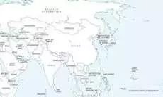

A new United Nations world map backed by India under the “Correct the Map” resolution has drawn attention for depicting Arunachal Pradesh and Aksai Chin as separate regions between Indian and Chinese territorial claims.
The map was first published on July 1 during discussions on the UN General Assembly resolution. It removes Arunachal Pradesh’s border with Nagaland and depicts the region as a separate entity bordering Assam and China.
Similarly, Aksai Chin is shown as a separate region, with its western side bordering India and its eastern side bordering China. The United Nations has not explained the changes.
The map also shows a dotted line representing the Line of Control (LoC) dividing Jammu and Kashmir between India and Pakistan. In a footnote, the UN said the line represents approximately the LoC agreed upon by India and Pakistan and that the final status of Jammu and Kashmir has not been agreed upon by the two countries.
The UN General Assembly last week adopted the African Union-backed “Correct the Map” resolution, which calls for more accurate and equitable cartographic representation, particularly of African regions. The resolution is non-binding but is expected to influence standard maps used by multilateral institutions.
India backed the resolution, with the Ministry of External Affairs saying its vote supported the principle of equal-area cartographic representation and did not amount to endorsement of any specific map, projection or depiction of national boundaries.
The ministry said India’s sovereign territory, including the Union Territories of Jammu and Kashmir and Ladakh, must be depicted according to India’s official map and that any inaccurate or misleading depiction was unacceptable.
India is yet to comment specifically on the UN map’s depiction of Arunachal Pradesh and Aksai Chin.
New Delhi maintains that Jammu and Kashmir and Ladakh, including Aksai Chin, are integral parts of India. It also maintains that Arunachal Pradesh is an integral part of Indian territory.