Myanmar quake: Satellite images confirm Naypyitaw Airport tower collapse
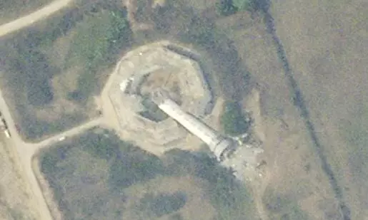
text_fieldsSatellite photo shows collapsed air traffic control tower at Naypyitaw International Airport after Myanmar earthquake. (Planet Labs PBC via AP)
Dubai: Satellite images from Planet Labs PBC, analyzed by The Associated Press, confirm that the powerful earthquake in Myanmar caused the control tower at Naypyitaw International Airport to collapse.
The photos, taken on Saturday, show the tower sheared from its base and lying on its side, with debris scattered around. The air traffic control tower managed all flights in and out of Myanmar’s capital, and its collapse has likely disrupted air traffic at the airport.
It remains unclear whether there were any casualties, though the tower was staffed at the time of the earthquake, which struck on Friday. With all communication and radar systems routed through the tower, the damage could significantly impact airport operations.
As a result, flights carrying rescue teams from China have landed at Yangon’s airport instead of directly reaching the heavily affected cities of Mandalay and Naypyitaw.
Meanwhile, the death toll from the devastating 7.7-magnitude earthquake has risen to over 1,000 as rescue workers continue to recover bodies from the rubble of collapsed buildings across the region.
With PTI inputs


