Philippines shaken by 7.5 magnitude earthquake, triggers tsunami alert
text_fieldsMindanao, Philippines, experienced a significant seismic event as a powerful 7.5 magnitude earthquake struck 117 kilometres east of Davao City.
The depth of 63 kilometres beneath the surface, as confirmed by the European-Mediterranean Seismological Centre (EMSC), brought immediate concerns about a possible tsunami for coastal areas, emphasising the region's vulnerability within the Pacific "Ring of Fire."
Last month, a similar tremor caused fatalities and extensive damage in the southern Philippines.
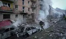
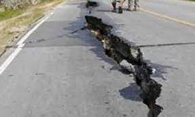
Despite the intensity of the quake, the Philippines avoided major casualties and substantial structural devastation. However, reports emerged of minor infrastructural damage, prompting swift government-led relief efforts in collaboration with the International Red Cross and Red Crescent Movement.
Promptly following the seismic activity, the Philippine Institute of Volcanology and Seismology (PHIVOLCS) issued a critical tsunami alert. Derived from localised tsunami databases, the warning cautioned coastal inhabitants about possible wave heights surpassing one metre above normal tides. This alert remained in effect until recently lifted, reported Reuters.
In preparation for potential repercussions, authorities mobilised resources and strategies. The Philippine National Police (PNP) deployed personnel to maintain order and curb the spread of misinformation, while the Office of Civil Defense (OCD) assessed damages and initiated aid efforts. Forewarnings concerning potential landslides and floods added urgency to the call for readiness.
When compared to the catastrophic 2004 Indian Ocean earthquake due to similarities in location and magnitude, distinctions in earthquake depth, fault types, and the effectiveness of warning systems set these seismic events apart. Notably, the Philippines' advanced warning mechanisms helped mitigate casualties in contrast to the 2004 disaster.
The 2004 earthquake occurred at a shallower depth, which can generate larger and more destructive tsunamis. It also had a magnitude of 9.1. It was caused by a megathrust fault, which is a type of fault that can produce the largest earthquakes. The recent earthquake in the Philippines was caused by a strike-slip fault, which is less likely to generate large tsunamis.
However, both earthquakes occurred in the Pacific Ring of Fire, a seismically active zone surrounding the Pacific Ocean.
Ring of Fire is a horseshoe-shaped zone of seismic activity that surrounds the Pacific Ocean. This region is characterised by frequent earthquakes and volcanic eruptions due to the movement of tectonic plates.
The Philippine archipelago is situated near several subduction zones, where one tectonic plate is forced beneath another. These subduction zones are prone to large earthquakes, which can generate powerful tsunamis. The Manila Trench, east of the Philippines, is a deep subduction zone that poses a significant tsunami threat.
The Philippines consists of over 7,000 islands, which increases the overall coastline and exposure to tsunamis. Tsunamis can affect multiple islands simultaneously, amplifying the overall impact.
PHIVOLCS remains vigilant, emphasising the need to brace for potential aftershocks and advising citizens to avoid coastal areas until the all-clear is declared. With the tsunami alert rescinded, authorities continue to monitor the situation closely.


