Why has not Thalassery awakened from the British era yet?
text_fieldsThe National Highway 66 runs along the shoreline of Thalassery, twisting and curving, frequently offering views of Arabian Sea and bluish skies - often they meet and become one as they always do. They never fail to take Thalassery town for a backdrop to their coupledom.
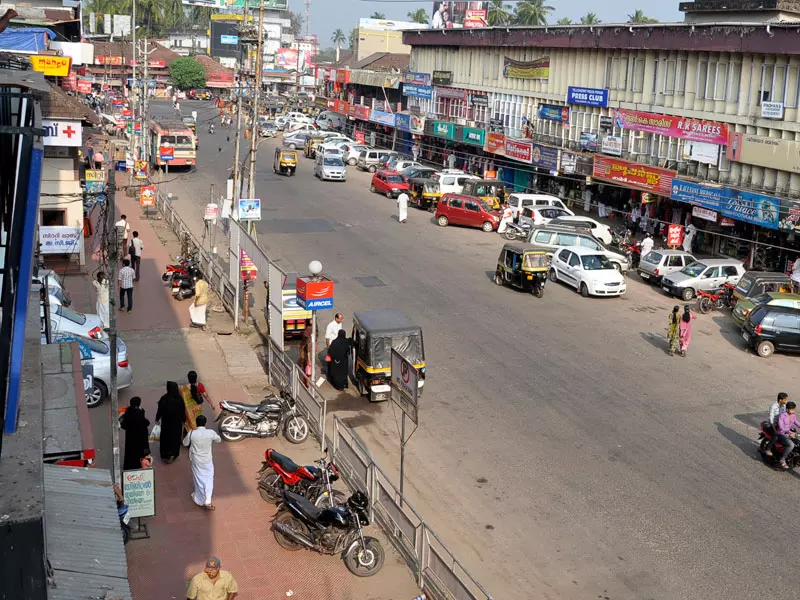
Town is swollen with buildings leaving behind fewer open places. Roads are thick with vehicles, and streets are narrowing from wayside parking and the town is noisy, dusty and headachy. Thalassery is not wakeful as it is daydreaming, seemingly, about another time -the 19th century. The feel of the past dominates the place with its marvellous heritage buildings. This is notwithstanding the glass-and-steel structures in the town today. For evidence, one has to just stroll through the streets that lead to the British era offices and buildings. Most of them are still in use making their past come alive. Take the sidewalk along the British era municipal office and across from the road is a working school from the same period. A side street runs past the statue of Hermann Gundert in granite. The German missionary, with his eyes still on the east, who had arrived here before the British came, began standing near the stadium long after the British left.
Keep to that road as it turns left to the side street, which curves and levels off. Now onwards the feel of the British era gets stronger, with Imperial Bank (now SBI) to the left. Next to it is the Cosmopolitan club, where the British unwound their evenings, where Thallassery's biggies do the same today. Along the road to the right is a British era office block, which today is the Sub Collector's office. Further away, past the British era public school is the stone wonder—Thalassery fort. That is where a lot of people come to relax their eyes on the horizon, looking at bobbing fishing boats in the Arabian Sea.
How many stones are too many? The British neither counted nor cut corners, because they wanted a lot when they began raising the fort in 1704. They were still relatively new to the area, despite having previously set up some warehouses on Thalassery coast in 1683 itself. That was well before the East India Company moved its headquarters from Surat to Bombay in 1687.
After successful run-ins against local chieftains across Bombay and Culcuta, the British began eyeing Malabar. They wanted a strategic foothold in the area against their European rival -the French, who had an outpost in Mahe. But the British were actually aiming at spices of Malabar, which they had tasted through Arabs.
Soon they arrived in Thalassery to set up headquarters for the Malabar region, which stretches between Palakkad to the south and Kavvayi River in Kannur to the north. On this strip of a land - previously called Thalacherry which the British tweaked as Tellicherry - they set up schools, police station, fire station, courts, hospital, a hill station, municipal office, spice plantations, and telegram office. They wanted everything to make English life workable in tropical Thalassery, for a permanent settlement, overseen from the fort.
They chose the seaboard for the fort, exactly where a woody hill had existed, to observe the French navy movements in the Arabia Sea. The place had been a weavers' settlement before the British obtained it from the local chieftain—Vadakkelamkur of the Kolathiri clan. Korangoth Nair of the same clan raised hell against the deal and attacked the British, nearly battering them. After strategically dividing the clan, the British had the one half helping them raise the fort. On August 8, 1708 this wholly laterite structure came into being, standing over 10 metres.
Imagine skinny natives all day heaving up stones on their heads, mixing mortar, climbing up wooden structures, while being ordered around by their white and brown masters. If the edifice looks so imposing today, how monstrously imposing it must have been back then! It begins with a triangular façade with two stone stairs, climbable from either side. There is a landing at the top, where a steel gate opens onto a pathway. Right there, on either side is a grotto-size guardroom, hollowed out the wall, where two sentinels could stand guard. They must have worn tunic frocks and combat boots like the stone carvings of guards on the outer wall. The structure, sitting in 2 acres, looks mildly slanting inwards—that was for withstanding earthquakes, attacks and erosion.
There are battlements on all sides, evidently for cannons. A row of rooms with heavy iron bars must have been offices with attached jails. Past a row of rooms to the left, a flight of steps leads to a secret tunnel, which many falsely believe is connected to the Kannur fort through the sea, 20 km away. No. The tunnel runs to the sea where it ends. There are dungeons inside the tunnel whose walls are plastered with egg white. How many eggs might have been broken!
As I walk around the redoubts, bastions, and the lighthouse, I understand the British had modelled the fort on castles in Britain: Pendennis Castle, Southsea Castle, and Yarmouth Castle. Most of them have piers like one Thalassery has. But the Thalassery pier sits a few blocks away to the south, unattached to the fort. The concrete pier is like an arm stretched to the sea, which the sea has nibbled to bones.
The fort was the administration headquarters, a coin mint, a barrack, an armoury and also a jail. Back then, a workday must have been really busy. The British officers managing schools, municipality, police station, fire station, plantation and courts interacted with the fort officials. One of the officials, the director of the fire brigade, is known to have been very conscientious and was obsessed with FIRE breakouts! The fire station, which is still in use, sat by the fort and he often tested his team's efficiency by phoning in false SOS. One day he made a call to the fire brigade alerting about a fire in Mahe. When the officials rushed in they were late by a minute and were suspended for negligence. He was watching them at the Mahe Bridge, crestfallen at their poor performance.
This officer recruited my friend Rajendran's father Mannan to work in the streets as an ARP (Air Raid Police) during the anticipated Japanese air raid in 1945. Mannan stood in the street with eyes popped up and ears cocked, watchful of skies all day. The director's grandson, who recently visited the fire station where the great grandpa had worked, shed copious tears of nostalgia.
Elsewhere in writing, author S. K. Pottekkatt noted how happy his friend Nettur P Damodaran (who later became a lawmaker) and the author himself had been on the night of August 14, 1947. Sitting at the fort, emptied of the British, they watched the dawn of new India from the ramparts of the old. Later they walked past the police station down in the street where Union Jack was still fluttering. Officers inside had no knowledge of the free India that had been born at the stroke of midnight.
The fort is intact even after 312 years. It is now a tourist spot alongside being a hangout for youngsters from surrounding villages. It is where lovers meet to weave their dreams as the sea breeze cooks them in salt. It is where dejected lovers seek solitude, and it is where the lonely and the depressed lick their wounds. The Imperial British must not have expected the turn the fort took three centuries later. But the feel the British era left behind still lingers in town like perennial mist.


