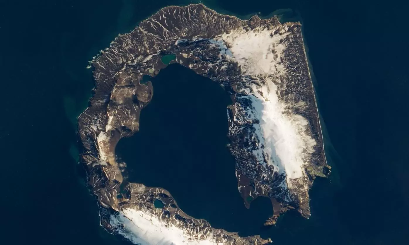
NASA shares stunning satellite image of 'Deception Island' in Antarctica
text_fieldsNASA Earth, known for routinely sharing captivating images and information about our planet and beyond, recently posted a satellite image of 'Deception Island' on its Instagram page.
The space agency also "dared" people to enter it.
Deception Island, situated off the Antarctic Peninsula, is a unique location in the world where ships can sail directly into the center of an active volcano. This horseshoe-shaped island surrounds Port Foster, which is both a harbor and the submerged caldera of the volcano.
In the Instagram post, NASA described the image, saying, "Satellite image of Deception Island surrounded by blue ocean water. The island is shaped like a horseshoe, and the land is rocky and mountainous with white snow on some peaks. There is an opening at the bottom where ships can sail into the blue waters of the harbor in the middle of the island."
The image was captured by Landsat 8 on March 23, 2018, providing a glimpse of the island when the volcano's summit was visible. Deception Island is one of only two active volcanoes in Antarctica, having erupted more than twenty times since the 19th century.
Despite its extreme isolation, Deception Island is the most visited tourist attraction in Antarctica, welcoming over 15,000 visitors each year. Tourists can enjoy the island's beaches, relax in geothermal baths, go on hikes, and witness one of the world's largest colonies of chinstrap penguins.
While Deception Island has been claimed by various nations over time, it currently operates under the governance of the Antarctic Treaty System.
Historically, the island served as a whaling and seal-hunting station from 1906 to 1931 and later as a British military base during World War II. Scientific research stations have also been established on the island, although some were destroyed by past volcanic activity.
Internet users expressed their fascination with the image, with one commenter exclaiming, "Wow. That's awesome,'' and another noting, ''If you look at Google Maps Street View there, you can find penguins on a spur of the trek. So adorable."


