Israeli bombardments leave Gaza in ruins: Before-and-after satellite images tell a grim tale
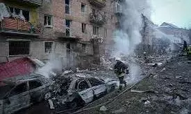
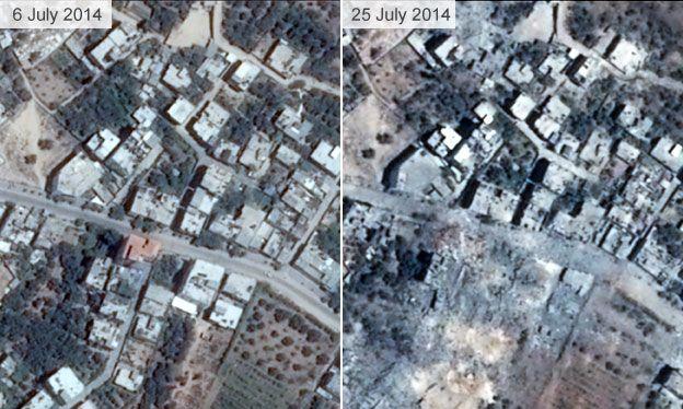
text_fieldsNewly released satellite images lay bare the devastation inflicted upon cities and towns in Gaza over nearly three weeks of relentless Israeli bombardments. The images, provided by Maxar Technologies and Planet Labs, capture the before-and-after scenes of the region, revealing the stark reality of the toll exacted by the conflict.
Apartment buildings, once standing tall, now crumple amidst the ruins of entire neighbourhoods. The city of Beit Hanoun, near the northern border with Israel, bears witness to the ferocity of the attacks, with four- and five-storey structures in various states of collapse. The Israeli Defense Forces (IDF) targeted Beit Hanoun intensely, striking it 120 times, citing it as a hub for Hamas militants.
The destruction extends beyond Beit Hanoun, with the Al Karameh neighbourhood north of Gaza City reduced to rubble. Images portray the aftermath of airstrikes, rendering residential buildings into grey wastelands. The UN reports that a staggering 42% of housing units in Gaza have become uninhabitable in the past three weeks, displacing between 400,000 to a million Palestinians.
In Beit Lahiya's Al-Atatra area, northern Gaza, satellite images depict entire neighbourhoods covered in ash and rubble—a testament to the widespread impact of the airstrikes. The UN sounds an alarm, warning that fuel supplies crucial for its operations in Gaza are dangerously close to depletion.
The coastal town of Al-Zahra, south of Gaza City, faced a barrage of Israeli missiles that flattened over 20 buildings. Residents, shell-shocked and displaced, grapple with the uncertainty of the future.
As the conflict rages on, the full extent of the damage remains unknown, leaving countless lives shattered and communities in despair.


